Nuestros servicios

Mapas precisos para optimizar cada etapa del cultivo.

Diagnóstico

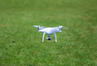
Detectamos estrés y variabilidad en tus cultivos con drones multiespectrales.

Drone flying over a vibrant green crop field capturing multispectral images.
Prescripción

Generamos mapas para aplicar insumos de forma localizada y eficiente.

Información georreferenciada que mejora la toma de decisiones agronómicas.

Seguimiento
Close-up of a detailed agricultural prescription map displayed on a tablet.
Aerial view of a diverse crop field showing different zones of vigor and health.

Proyectos

Mapas precisos para mejorar cultivos.

Drone flying over a vibrant green crop field capturing multispectral images.
Diagnóstico

Detectamos estrés y variabilidad.

Close-up of a multispectral map showing crop vigor differences.
Prescripción

Mapas para aplicación localizada.

Agronomist reviewing georeferenced crop data on a tablet in the field.
Pulverizadora machine applying inputs guided by prescription maps.
Seguimiento

Monitoreo durante todo el ciclo.

Eficiencia

Optimización de recursos y tiempo.

Drone flying over a vibrant green crop field capturing multispectral images.

Galería

Imágenes que muestran el análisis detallado de cultivos con drones.

Close-up of a multispectral map highlighting crop variability zones.
Agronomist reviewing georeferenced maps on a tablet in the field.
DJI Mavic 3 drone preparing for a flight over a patchwork of agricultural plots.
Colorful prescription map ready to be uploaded to a fertilizer applicator.
Panoramic view of healthy crops with visible zones of stress detected by drone.